Last reviewed:
The Mekong is the longest river in Southeast Asia and one of the most biologically productive on earth. It is also one of the least standardised: its length is quoted anywhere between 4,350 and 4,900 kilometres depending on where the source is fixed, it has a different name in every country it crosses, and for part of each year one of its major tributaries flows the wrong way.
Quick summary
| Length | Commonly given as about 4,350–4,900 km. The range reflects genuine disagreement over the exact source on the Tibetan Plateau, not sloppiness. It is the 12th-longest river in the world by most rankings. |
|---|---|
| Source | The Tibetan Plateau in Qinghai, China — most surveys place it near the Lasagongma spring, above 5,000 m. |
| Countries | Six: China, Myanmar, Laos, Thailand, Cambodia, Vietnam. |
| Basin area | Roughly 795,000 km², supporting an estimated 60 million people in the Lower Mekong Basin alone. |
| Mouth | The Mekong Delta in southern Vietnam — historically nine distributary mouths, hence Cửu Long, "Nine Dragons". Two have since silted up. |
| Biodiversity | Second only to the Amazon in freshwater fish diversity, with over a thousand recorded species. |
| Navigable? | Not continuously. The Khone Phapheng falls on the Lao–Cambodian border have always blocked passage between the delta and the upper river. |
See Mekong River tours and live prices
One river, six names
| Country | Local name | Meaning |
|---|---|---|
| China | Lancang Jiang (澜沧江) | "Turbulent river" |
| Myanmar | Mae Kaung | From the Thai/Lao form |
| Thailand / Laos | Mae Nam Khong | "Mother river Khong" — the origin of "Mekong" |
| Cambodia | Tonle Thom | "Great river" |
| Vietnam | Sông Cửu Long | "River of Nine Dragons" |
The English name is a compression of the Thai and Lao Mae Nam Khong. Almost every language along the river calls it a variation of "the great river" or "the mother river", which tells you most of what you need to know about its role.
The course, section by section
Upper Mekong: China
Roughly half the river's length lies in China as the Lancang, dropping steeply through deep gorges in Qinghai and Yunnan — at one point running parallel to the Yangtze and the Salween within a few dozen kilometres, in the Three Parallel Rivers region. The upper basin contributes a disproportionate share of the river's dry-season flow and almost all of its historical sediment load. A cascade of large hydropower dams has been built on this stretch since the 1990s.
The Golden Triangle: Myanmar, Laos, Thailand
The Mekong briefly forms the Myanmar–Laos border, then the Thailand–Laos border for several hundred kilometres. This is the Golden Triangle stretch — broad, brown, fast in flood, and studded with rocky rapids in the dry season. Below Huay Xai it carries the slow boats to Luang Prabang.
Middle Mekong: Laos and Cambodia
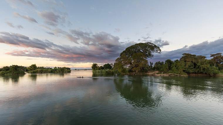
Through Luang Prabang, Vientiane, Savannakhet and Pakse, the river settles into wide sweeping bends. Then, at Si Phan Don, it spreads to around ten kilometres across and shatters into hundreds of islands before collapsing over the Khone Phapheng falls — not tall, but the largest waterfall in Southeast Asia by volume and the reason the Mekong has never been a through-route from the sea to China.
Lower Mekong: Cambodia
Past Stung Treng and Kratie — where the last Irrawaddy dolphins live in deep pools — to Phnom Penh, where the river performs its most distinctive trick.
The delta: Vietnam
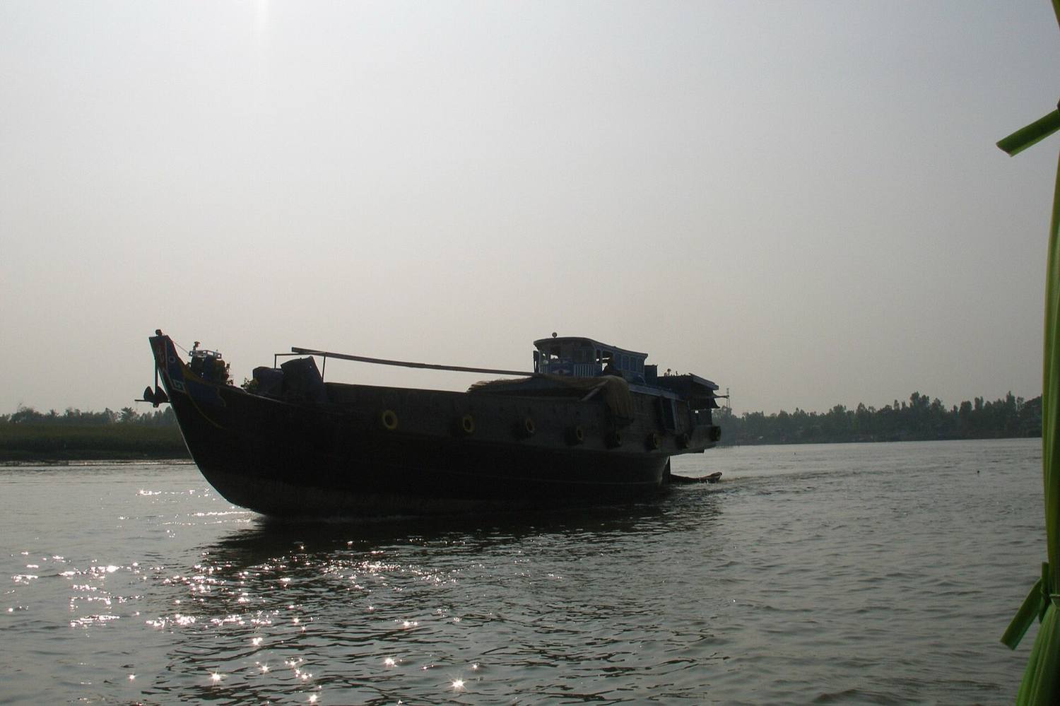
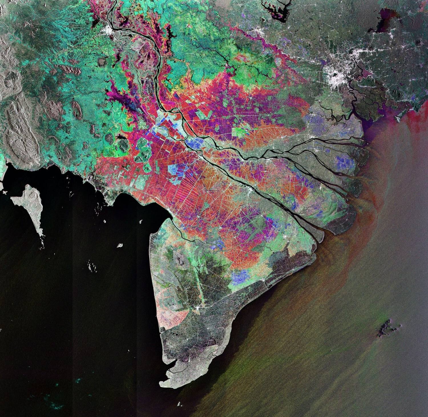
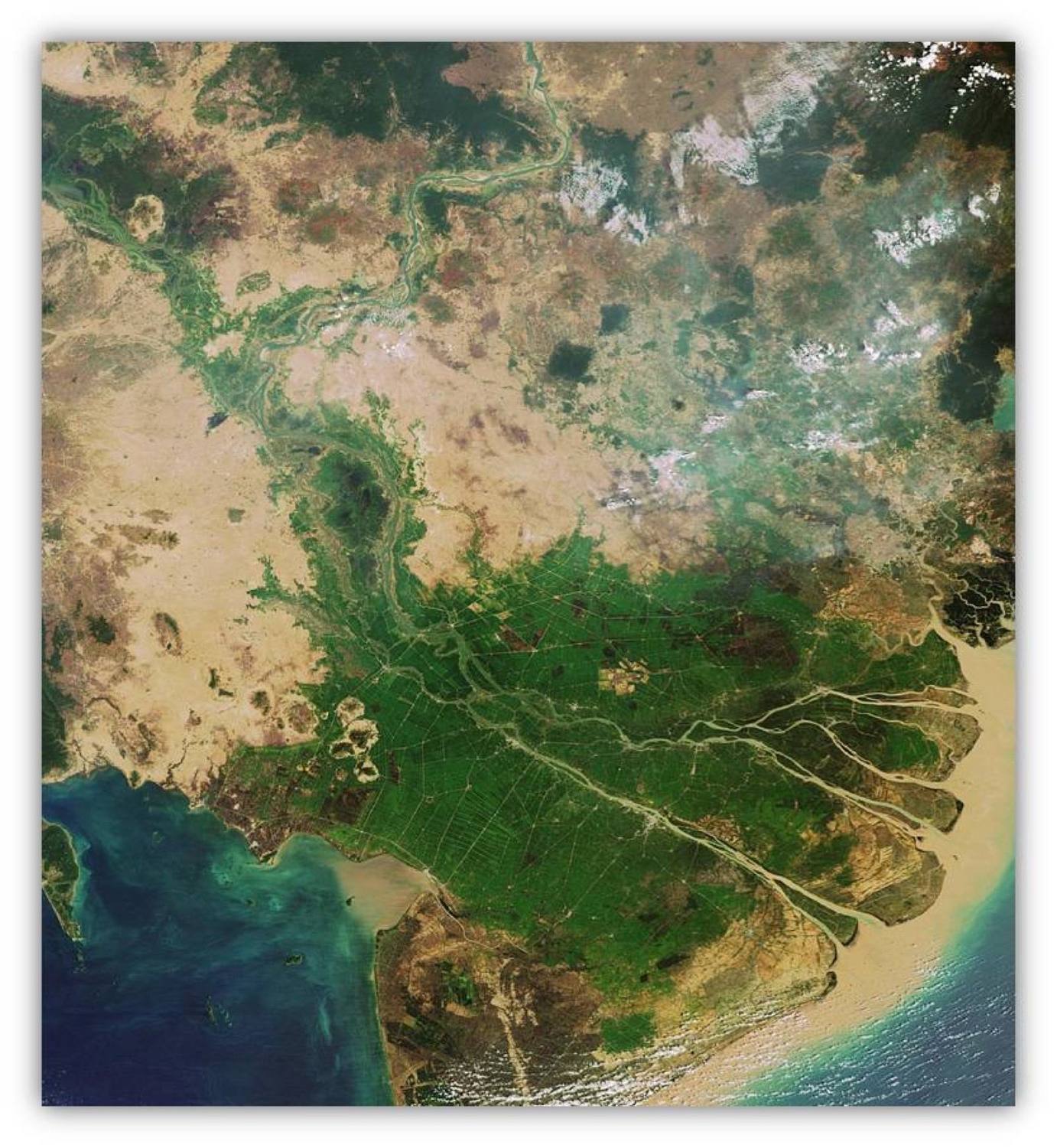
Below Phnom Penh the river divides into the Mekong proper (the Tien in Vietnamese) and the Bassac (the Hau), then subdivides again and again across roughly 40,000 km² of the flattest land in Vietnam. The delta produces around half of Vietnam's rice and a large share of its fruit and aquaculture. See our Mekong Delta tours guide for how to visit it.
The Tonle Sap reversal
At Phnom Penh the Mekong meets the Tonle Sap river, which drains Southeast Asia's largest freshwater lake. For most of the year the lake drains into the Mekong. From around June the monsoon and Himalayan snowmelt raise the Mekong faster than the lake can discharge, and the flow reverses: water pushes upstream and floods into the lake, which can expand several times over in surface area and rise by several metres.
The flooded forest around the swollen lake becomes a nursery for fish on an extraordinary scale — the Tonle Sap is one of the most productive inland fisheries in the world, and a large share of Cambodia's protein comes from it. Around late October or November the Mekong falls, the river turns again, and the lake drains. The turning is marked by Bon Om Touk, the Cambodian Water Festival, with longboat racing at Phnom Penh.
The reversal is not folklore or a curiosity — it is the mechanism that makes the lower basin's fisheries work. Changes to the timing and size of the flood pulse, whether from dams or from climate variability, are the central issue in Mekong water politics.
What lives in it
By fish diversity the Mekong is second only to the Amazon, with well over a thousand recorded species and new ones still being described. It also holds an unusual concentration of freshwater giants.
- Mekong giant catfish (Pangasianodon gigas) — one of the largest freshwater fish in the world, historically reaching around three metres. Critically endangered.
- Giant freshwater stingray (Urogymnus polylepis) — among the largest freshwater fish ever recorded; a specimen caught and released in Cambodia in 2022 weighed roughly 300 kg.
- Irrawaddy dolphin (Orcaella brevirostris) — a round-headed freshwater dolphin surviving in deep pools between Kratie and the Lao border. Critically endangered, with roughly ninety animals left. See our Cambodia guide.
- Siamese giant carp, giant barb, freshwater eels and hundreds of migratory species that move between the delta, the Tonle Sap and the upper tributaries to spawn.
- Birds: the seasonal wetlands support sarus cranes, storks, and large waterbird colonies at sites such as Tram Chim in Dong Thap and Tra Su in An Giang.
The river as infrastructure
Around sixty million people live in the Lower Mekong Basin, and the majority depend on the river directly — for fish protein, for irrigation, for transport, and for the sediment that has built and maintained the delta's soil for millennia.
- Fisheries. The basin's inland catch is among the largest in the world and provides a substantial share of the animal protein consumed in Cambodia and Laos.
- Rice. The Vietnamese delta produces roughly half the country's rice and a large majority of its exports.
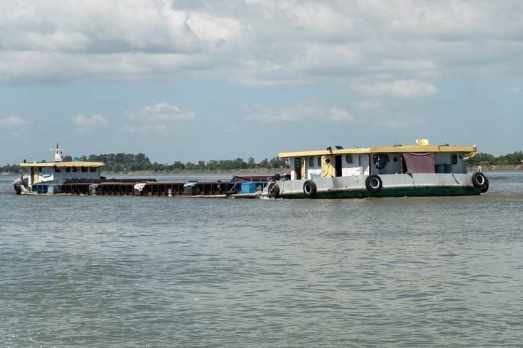
- Transport. In much of Laos and the Cambodian north, the river still carries goods and people where roads do not reach.
- Hydropower. A cascade of dams on the Chinese Lancang, plus mainstream projects in Laos such as Xayaburi and Don Sahong, and many tributary dams.
The pressures on it
Any honest guide has to say this part. The Mekong is under strain, and it is visible on the ground.
- Sediment. Dams trap sand and silt upstream. The delta receives far less than it once did, which means it is no longer building itself as fast as the sea erodes it.
- Subsidence and saltwater intrusion. Groundwater extraction is causing the delta to sink while sea levels rise. Saline water pushes tens of kilometres inland in the dry season, and severe intrusion events in recent years have damaged rice and fruit crops.
- Altered flow. The natural flood pulse — high water in the wet season, low in the dry — is being flattened by upstream storage, which disrupts fish migration and the Tonle Sap's flood cycle.
- Sand mining. Large-scale extraction of riverbed sand for construction deepens channels and destabilises banks; riverbank collapse is now common in the delta.
- Governance. The Mekong River Commission, formed under the 1995 Mekong Agreement between Cambodia, Laos, Thailand and Vietnam, coordinates data and consultation. China and Myanmar are dialogue partners rather than members, which limits what it can do about the upper basin.
None of this makes the river less worth seeing. It makes seeing it, and understanding what you are looking at, more useful.
Where to actually see the Mekong
| Country | Best places | What makes it different |
|---|---|---|
| Vietnam | Can Tho, Ben Tre, My Tho, Chau Doc | Density. Floating markets, canals, orchards, life lived on water. |
| Cambodia | Phnom Penh, Kratie, Kampong Cham | The Tonle Sap junction and the last freshwater dolphins. |
| Laos | Luang Prabang, Si Phan Don, Vientiane | Distance and emptiness; the two-day slow boat; the falls. |
| Thailand | Chiang Khan, Nong Khai, Golden Triangle | The Thai bank, with the river as a border rather than a home. |
| China | Xishuangbanna, Yunnan | The Lancang in its gorges, before it becomes the Mekong. |
When to go
- November–February. The best window almost everywhere: dry, cooler, water still high after the flood.
- March–May. Hottest and lowest. Sandbars appear, some cruise itineraries shorten, and northern Laos and Thailand can be hazy with agricultural smoke.
- June–August. Rains begin; the Tonle Sap turns; landscapes green up.
- September–November. Peak water. The Vietnamese delta's floating season, the Cambodian floodplain at its fullest, and the Lao falls at maximum volume.
Practical notes
- Boat prices are per boat almost everywhere on the river. Agree the total and the duration before boarding.
- The river is not continuously navigable. You cannot travel by boat from the delta to Laos; the Khone Phapheng falls block it. Multi-country itineraries use road transfers.
- Border crossings on the water exist between Vietnam and Cambodia (Vinh Xuong / Kaam Samnor) but not between Cambodia and Laos, where the crossing is by road.
- Do not swim in the main channels. Currents are strong, traffic is heavy and visibility is nil.
- Eat the fish. Sour fish soup, grilled snakehead, caramelised claypot — the river's cuisine is the best argument for its conservation.
Frequently asked questions
How long is the Mekong River?
Estimates range from about 4,350 to 4,900 km, because surveys disagree on exactly where the source lies on the Tibetan Plateau. By most rankings it is the twelfth-longest river in the world and the longest in Southeast Asia.
Which countries does the Mekong River flow through?
Six: China, Myanmar, Laos, Thailand, Cambodia and Vietnam. It rises on the Tibetan Plateau in China, forms long stretches of the Myanmar–Laos and Thailand–Laos borders, and reaches the sea through the Mekong Delta in southern Vietnam.
Where does the Mekong River start and end?
It starts on the Tibetan Plateau in Qinghai, China, most often placed at the Lasagongma spring above 5,000 metres. It ends in the Mekong Delta in southern Vietnam, historically through nine distributary mouths — the origin of the Vietnamese name Cửu Long, "Nine Dragons".
Why is the Mekong Delta called the River of Nine Dragons?
Because the river historically reached the South China Sea through nine mouths. Two have since silted up, so seven remain active, but the name Cửu Long has stuck.
Can you travel the whole Mekong by boat?
No. The Khone Phapheng falls on the Lao–Cambodian border have always blocked continuous navigation, and rapids in the upper river prevent it further north. Multi-country river journeys combine boat sections with road transfers.
What animals live in the Mekong River?
Over a thousand recorded fish species — second only to the Amazon — including the Mekong giant catfish and the giant freshwater stingray, both among the largest freshwater fish in the world. Critically endangered Irrawaddy dolphins survive in deep pools near Kratie in Cambodia.
Why does the Tonle Sap river flow backwards?
From around June the Mekong rises faster than the Tonle Sap lake can drain into it, forcing the connecting river to reverse and flood water upstream into the lake, which expands several times over. When the Mekong falls in late October or November the flow turns again.
Is the Mekong River in danger?
It is under significant pressure. Upstream dams trap sediment and flatten the natural flood pulse, sand mining destabilises banks, and the Vietnamese delta is subsiding while saltwater pushes further inland each dry season. The Mekong River Commission coordinates the four lower-basin countries, but China and Myanmar are dialogue partners rather than members.